…or to paraphrase Theodore Roosevelt “Tread carefully and carry a big stick“…two concepts directly related to my summit of Mt Ngauruhoe yesterday…

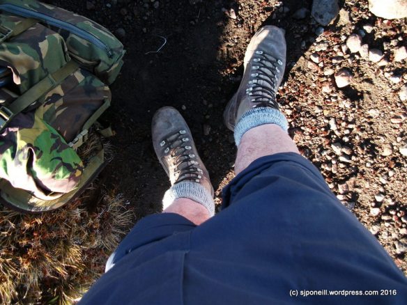
This is Stick. Stick is a little miffed that it missed out on going up Mt Tongariro last week, but that’s kinda what happens when you hide away in a dark corner of the garage. Stick is way more useful than lightweight aluminium walking poles which are too flimsy to brace your weight against. Stick is also really good as a counter-balance and a brace when descending scree slopes…

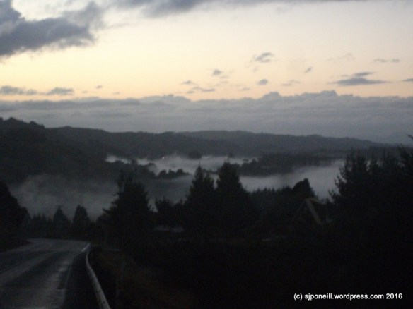
Tuesday and yesterday offered the best weather windows for another go at Ngauruhoe; yesterday had the least wind and Tuesday was off the list when I remembered that I had to speak to a visiting Duke of Edinburgh group from Karamu School. The day opening with a beautifully clear sunset that boded well for the day’s adventure.
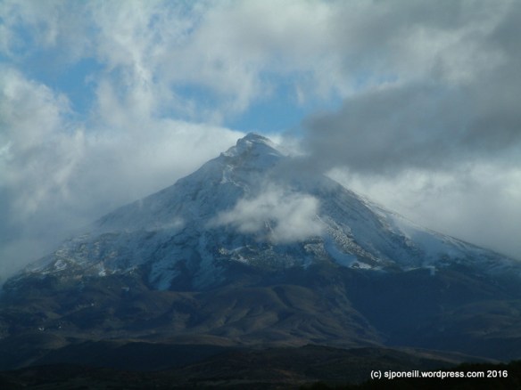
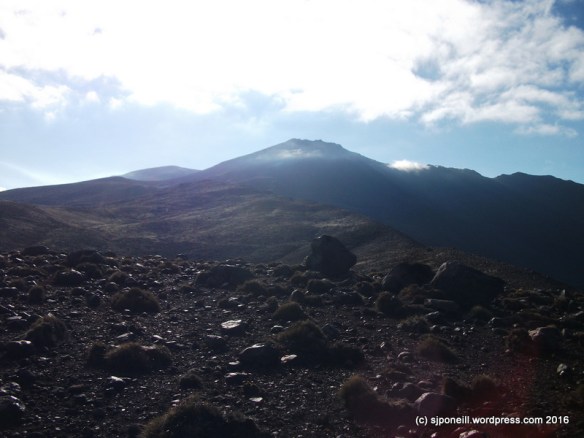
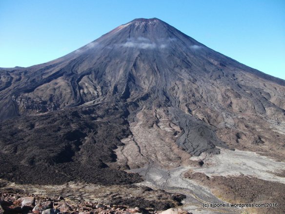
Mt Ngauruhoe (thrower of rocks) is technically ‘only’ a vent on Mt Tongariro but because it is now higher than its parent and such a prominent feature, it is counted as a mountain in its own right. Don’t be fooled however, it is still an active volcano and carries with it, its own unique hazards: it is very steep (a consistent 30 degrees), very smooth and covered in loose rock.

It was pretty brisk at Mangatepopo car park with the normal number of Alpine Crossing walkers milling around. The sky was clear, and the sun beaming down but the temperature was barely above zero…the best way to keep warm: get moving…
Many walkers were way over-dressed and already shedding layers in the first couple of kilometres…a number, by Soda Springs, were already quite oblivious of their surroundings and had to be asked to allow faster walkers past…I don’t really see the point of doing a walk like the Crossing if you are going to zone out before the end of the first leg…

A decent frost crisped up parts of the track lying in the shadow of Mt Tongariro, a good reminder that winter is drawing closer and with it, winter ground conditions. Although there was quite a bit of frost on the board-walks, they weren’t slippery but that won’t be too far away…
I made good time up to the top of the Devil’s Staircase, about 90 minutes. At this sign, turn right…in summer ground conditions, i.e. no snow on the ground, a trail has been worn from the sign towards the base of the volcano.

We’re not kidding!!
Because the sides of Ngauruhoe are so steep and smooth, any rocks knocked loose – and many of the surfaces aren’t that stable to start with – can roll hundreds of metres, picking up a lot of speed along the way. On my way up, I saw two torso-sized boulders crashing down the scree slopes: if they collected anyone on their way down, the results would be serious injury and a free helicopter ride…

As this peters out, a series of blue and orange track markers indicates the route to the beginning of the real climb…
The trick to a safe and successful ascent of Ngauruhoe is to work your way up the solid rock formations, avoiding the scree slopes as much as possible: they are really hard work going up and unstable to such a point that upwards motion, slipping and sliding, will generate lots of mini rock slides.
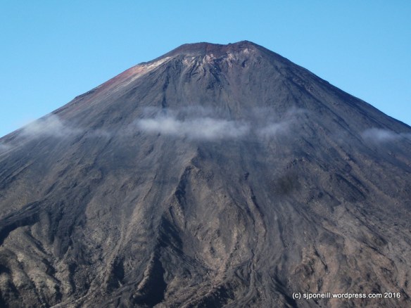
As a very young volcano, a lot of the rock on Ngauruhoe is very rough and sharp and this is more pronounced the closer to the summit that you get. Hard shell gloves are a good idea – your nice wool Icebreaker gloves will last about five minutes – and I’ll be digging out my leather shooting gloves before I come back up here.
Another incredibly highly recommended piece of kit for Ngauruhoe is a climbing helmet. Unless you are fortunate to strike a day when you have the mountain to yourself (unlikely to occur with decent weather conditions), there is a consistent trickle of small (and not so small) rocks coming down from climbers ahead of you. In addition some of the rock faces on the way up are quite steep with potential drops of a few metres: you may be the best rock scrambler in the world, the that mightn’t help you if you get wiped out by someone less experienced ahead of taking a tumble.

Something like this…
…and, no, I didn’t wear a helmet myself…something that a. my school group from Karamu School called me on when I caught up with them at Soda Springs on my way back and b. that I intend to do something about before I return…I only saw one group up there with helmets but lots of near misses…
Stick was really useful as a brace on the ascent and there was only one time where I needed to use both hands for climbing…everybody that I saw with walking poles struggled with them: they are too flimsy to be used as a brace and, more often than not, tend to just get in the way: you do need at least one hand free for climbing. I carried a set of poles up for a young American lady who had come expecting a walk not a climb and who was reduced to throwing her poles ahead of her as she used both hands to climb…
This young lady had also been left behind by the rest of her group which is pretty untidy – if you start as a group, you go as a group and finish as a group – more so, when she did not have any water on her. I carry heaps and was happy to share, bolster her confidence and encourage her to the summit but she was not prepared for this sort of activity and was having a pretty miserable time – which defeats the whole point of doing things like this…

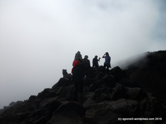
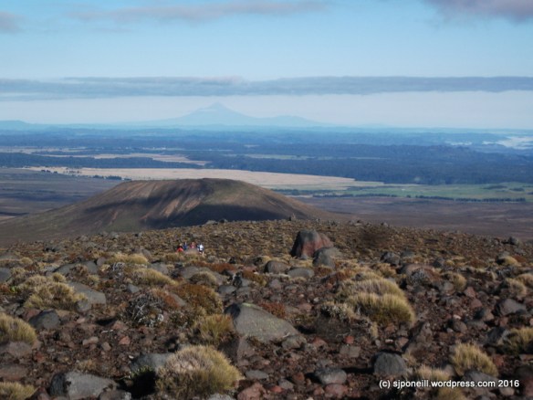
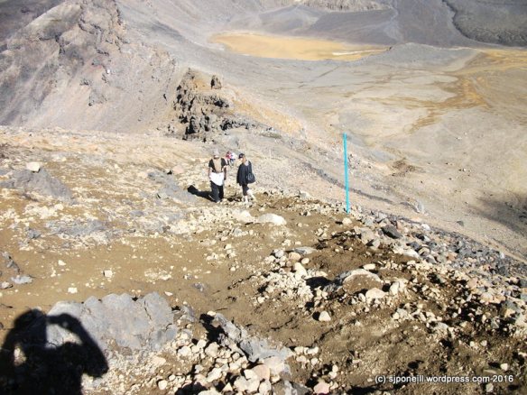
It took me about two hours to the summit: spectacular views!! But all that rock is very hard and very sharp with a some big potential drops of the unwary or unsteady of foot..

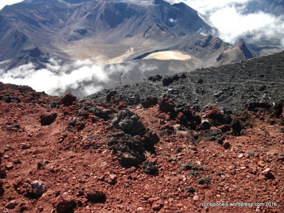
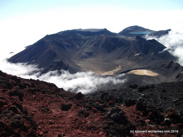
The top of the cloud was sitting around 1400 metres but all the good stuff was visible, looking here across Red Crater to Blue Lake; lower centre, you can see the Tongariro Alpine Crossing heading up towards its highest point of 1868 metres, and the trail to the summit of Mt Tongariro. climbing off to the left…
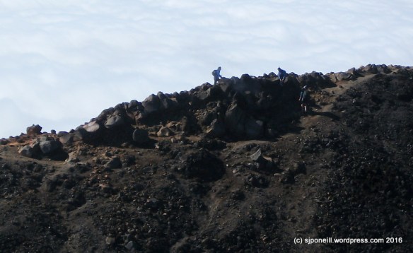
There are active vents (fumaroles) on Mt Ngauruhoe and steam was clearly visible from this one on the summit: you can just make it out at four o’clock from the left-hand figure on the skyline…
Without wanting to repeat myself, this volcanic rock is hard and sharp…about three steps into my descent, I slipped and slip a couple of metres and have some nice skin to grow back on my left wrist…slow and steady is the way…

The easiest and safest way to descend Mt Ngauruhoe is down the scree slopes to the west of the rock that you climbed up on. Avoid the rocky surfaces: they are not very stable and you WILL set off rock slides!! Stick to the channels of already disturbed scree where there are less rocks.
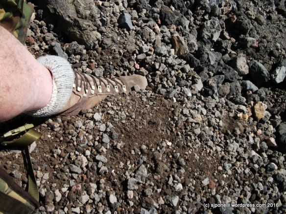
Stick was really useful for bracing myself on the scree…this is soft and loose…if you are wearing ankle boots or runners/trainers (really?), gaiters would be a good idea as you will be sinking into this stuff up to and over your ankles. Don’t be an idiot and leap your way down the scree slopes: not only are you kicking loose a lot of loose material that hazards those below you, but if you strike a fixed rock beneath the surface, you are likely to lose your balance and become your own rock slide…you can descend quickly and safely without being an idiot…
Be aware of your surroundings…I spent a lot of my descent time watching behind me for rocks knocked loose by other people…not everyone calls ‘rock’ when they set one loose…think a couple of steps ahead as to where you will go if a rock comes in your direction…

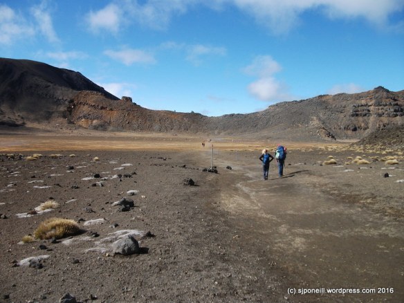
…and finally back on the trail just before the junction with the Alpine Crossing…I was tempted to carry on up to Red Crater, across to Mt Tongariro and come back down the way I went up last week but I didn’t fancy descending down through that cloud on an unmarked trail…

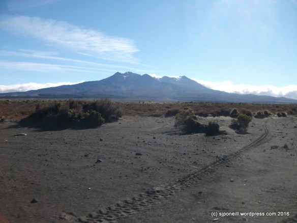
A final shot from just short of Mangatepopo car park…perversely the view was clear with that little cloud rolling in in the time it took me to get out my camera…
Total time was about 6 1/2 hours but that includes a decent break for lunch, assisting the young American lady and stopping to talk to groups along the way. My total walking time, with just breather breaks would have been in the region of 5 1/2 hours…
Insights
- Gloves – a good set of well-fitting leather gloves will save you skin
- Helmet – may save your life.
- Decent sturdy footwear – not runners! Consider gaiters to keep the scree out of your boots/shoes.
- If you must take walking poles: either take only one of have a backpack that will let you carry them if you don’t need them.
- Tread carefully: be sure you are stepping onto firm ground before you transfer your weight…
- Jeans make the climb – and it is a climb not a walk – hard work. I was comfortable in shorts and an Icebreaker T-shirt all day BUT I had good clothing for cold/wet weather on me if I needed it…
BE AWARE OF YOUR SURROUNDINGS – YOUR SAFETY IS YOUR RESPONSIBILITY!!!
It was disappointing to observe the number of people who were physically and psychologically unprepared for Mt Ngauruhoe…many thought it was just a walk and struggled with the climb and the height – one loud American complained the whole way up about his fear of falling – others got up all right but had no idea how to get down…here’s a hint: it’s easy to climb UP the rock; climbing down the same way is not nearly as easy and you’re making people still coming up work around you…
This, I think, puts a lot of the responsibility back onto us locals to ensure that we are setting visitor expectations appropriately in all our contact with them, and through our websites, and social media engagement…Mt Ngauruhoe is not a place where ‘just do it’ is a good or safe philosophy…


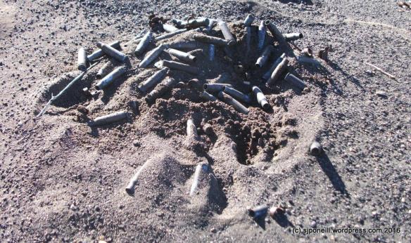
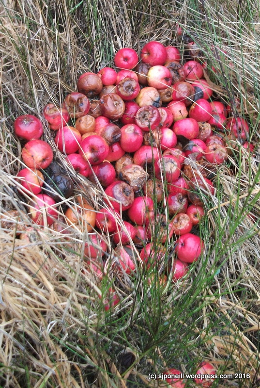 These apples were dumped at the side of the lookout car park. Sure, they will eventually break down but that still doesn’t making this blatant dumping OK…


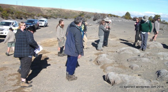
 Zone 1 of the Waiouru Military Training Area is one place that I never thought I would find myself again…
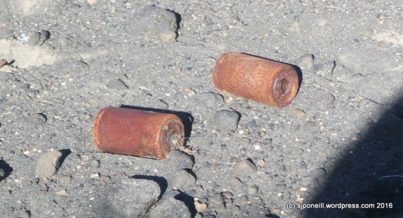


 …taking the first right down Fishers Road where…
 …after a couple of kilometres, you come to the start of the trail proper. Yes, you could just drive here but it’s a nice walk along the road and you wouldn’t want to drive only to find that the freedom campers have taken up all the parking:


 The lookout is a nice spot for the break…
 …with good views of the Falls in the distance.


 The first activity each year, on New Year’s Day, is the family kite day…
 Even though the first of January is technically in the middle of summer, true summer here often does not kick in until February….
 Pleasant but overcast days like this are common for this period of the season…


