Field observations TAC 26/8/2017

Yesterday afternoon, I received this email from a  good friend who is an experienced guide in Tongariro National Park. The initial target audience was the visitor information centres around the Central Plateau – that audience has now grown…

To whom it may concern,

I am an alpine guide, currently working on the Tongariro Alpine Crossing. This is my fourth season on the TAC. My primary duty of care is to the safety and well-being of the clients on my trip, however I am often asked by freedom walkers for information and advice. Far too many people recreating in Tongariro National Park are uninformed about the hazards on the TAC and are unprepared for the conditions they will encounter. In some cases, people are putting themselves in harms way or endangering those around them and I feel obliged to intervene. This is actually quite common, but most of us guiding in Tongariro see that we act as kaitiake for the people and the land and don’t hesitate to offer assistance. This is an ongoing problem and the number of people putting themselves in danger increases exponentially each season. This is a problem that many people involved in tourism, recreation, and the outdoors community in Central Ruapehu are well aware of.

I would like to make it clear that I am not against freedom walking the TAC in winter, but that I am against trail users getting bad advice or no advice, going unprepared, and exposing themselves to unnecessary risks.

I am writing this letter because of what I saw while I was guiding on the TAC on Saturday, 26 August 2017. The number of people walking the track in completely inappropriate gear with no clue and no humility was SHOCKING. People dressed only in sneakers and blue jeans, without rain jackets or warm hats and gloves. There was a much higher than average number of freedom walkers on the track that day. At a guess, I would say that there were a few hundred. Tongariro Expeditions were operating their transport only service that day, as well as a large number of groups both large and small providing their own transport.

It is my opinion that when transport only services operate in winter, the public is watching. They see “no risk” when in reality there exists a “low risk”. Understanding that difference is critical. It is also imperative that people understand the difference between a forecast and a guarantee. Weather in New Zealand mountains is unpredictable and rapidly changeable. I believe that the greatest danger to people on this day was the weather, and the perceived risk.

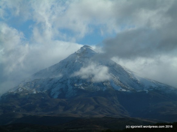
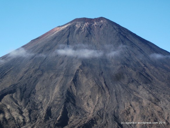
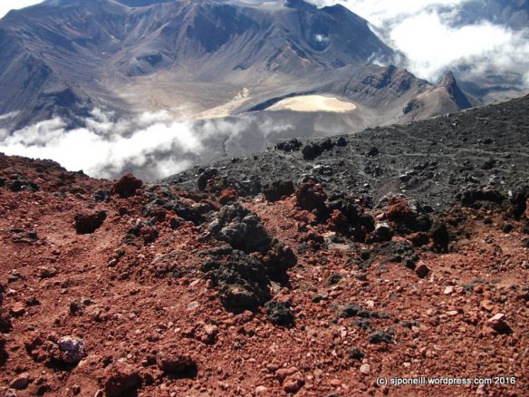
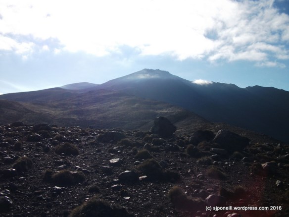
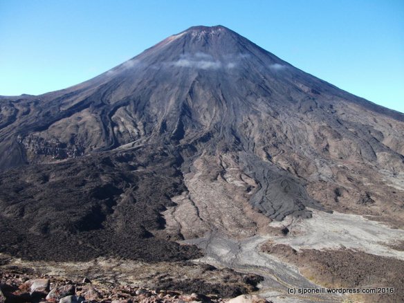
The forecast on Saturday 26 August 2017, according to Metservice, called for fine conditions and light winds. On paper, truly a beautiful day! My observations on track told a very different story. The lenticular clouds capping Ngauruhoe meant winds were much stronger than the 15km/h in the forecast for the Red Crater. Metvuw charts showed rain to the northwest of Tongariro, so I knew that those stronger than forecast winds would also bring clouds. In spite of the forecast I could see that we were in for a cold day, with no sun, strong winds, and white-out conditions. Which is exactly what we got. The Red Crater was being hit by 50km/h winds and the wind chill was hovering around -8. Cloud in the Central Crater caused poor visibility, fluctuating between 50 meters and 500 meters of visibility. These are challenging and hazardous conditions.

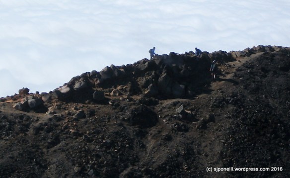
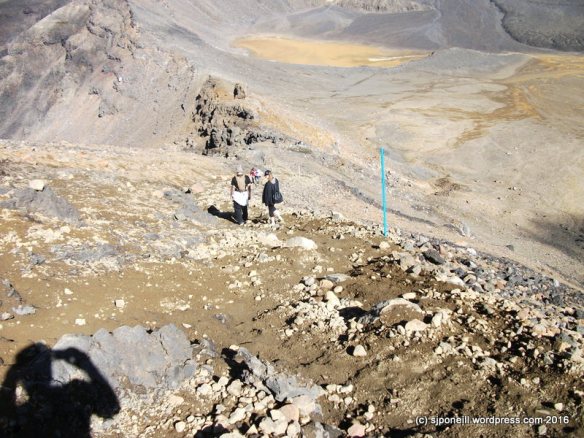
One unprepared (cold and scared) freedom walker was rescued (from Shelter Rock) by other hikers on their descent from the summit of the TAC and given extra gear and guidance back to the start of the track (Mangatepopo Car Park).  People were observed walking on cornices on the Red Crater, walking out onto the ice on the Emerald Lakes, onto the ice on the Blue Lake, and were advised of the dangers they were putting themselves into. Many people without proper attire continued to walk into worsening conditions in spite of warnings from myself, other guides, and members of a local tramping club.

Waikato Tramping Club was on their annual winter Tongariro trek and spent lot of time and energy trying to warn people of the risks involved in trekking in alpine conditions without proper gear or know-how. They attempted to turn around many people on this day that were unaware of the danger they were putting themselves in and unaware of the hazards on the TAC. I have reached out to the club and encouraged them to write a letter with their observations.

I am passionate about the outdoors. I love Tongariro. I love creating safe experiences that are fun and memorable. If I can, I want to help more people come home safe and happy after a day in our mountains. I am reaching out to your organisation with my field observations because I believe that we are allies in this goal. I have provided below descriptions of the hazards, risks and consequences that are common on the TAC in winter, as well as the MetService forecast for the day. I personally observed people exposing themselves to each of the hazards below on this day. It is my sincere hope that this letter is useful in some way.

Thank you for your consideration,


TAC 26 aug 17 - 2TAC 26 aug 17

Below is a list of some hazards that exist on the TAC in winter. I have omitted to speak about avalanche hazards, as the Backcountry Avalanche Advisory does an excellent job of detailing the risks and hazards on a daily basis.

Walking on cornices

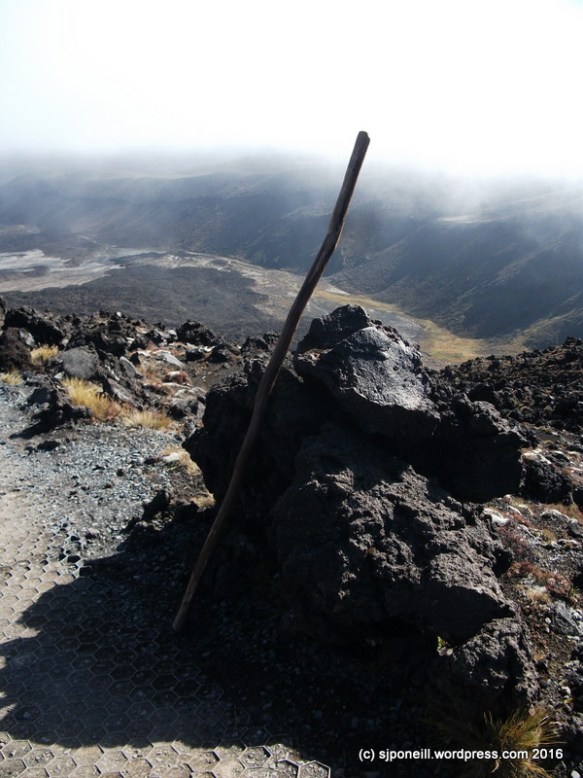
-large cornices exist around the rim and summit of the Red Crater. There are many others throughout the TAC but these are the cornices that are easiest to walk onto without realizing what you’re doing

-the risk is that by walking onto a cornice you will cause it to break and you will fall

-the consequences of breaking a cornice are VERY HIGH and potentially life-threatening, as you would fall 50+ meters and likely be buried in snow from the falling debris

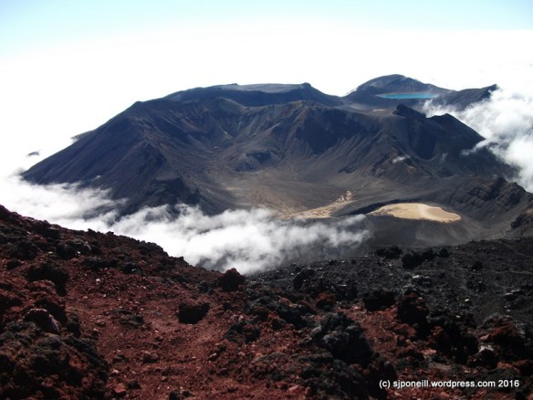
Walking on the ice covering the Emerald Lakes

-the lakes are not well frozen and are currently thawing, so the risk of breaking the ice and falling into the lakes is VERY HIGH

-consequences of of falling through the ice into the lake are SERIOUS and potentially life-threatening, as both drowning and hypothermia are likely outcomes

Walking on the ice covering the Blue Lake

-the risk posed by walking on the Blue Lake is precisely the same as the Emerald Lakes, but the consequences are higher, as the size and depth of the lake would pose much larger problems for rescue

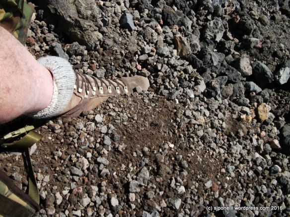
Not having the appropriate gear

-sunglasses, warm hats and gloves, boots, rain jackets, and intelligent layers are a must in an unpredictable alpine environment such as the TAC. To venture out unprepared is to risk frostbite or hypothermia, or in the case of not having sunglasses you are risking snowblindness

Not having the appropriate equipment

-at the very least it is necessary to carry a topographic map and compass (and know how to use them), the risk is that you will get lost. Poor visibility and featureless snow-fields (such as the Central and South Crater) create navigational challenges. Additionally, the summer track is generally considered unsafe in common winter conditions and an alternate track exists, many people aren’t even aware that they may encounter more than one track and this creates confusion

-often it is necessary to carry (and know how to use) crampons, ice-axe, and helmet. Without this gear you risk sliding down steep and long icy surfaces. Sliding can carry high consequences.

The feelings expressed here are shared by many of us who live up here: as much as we want people to come here and enjoy this wonderful location, we want them to do it safely.

Many of our visitors – and not just the international ones – don’t have any frame of reference for the hazards of an alpine environment…the closest many of them will get is watching Cliffhanger or Everest in FullHD with the woodburner fully cranked up…
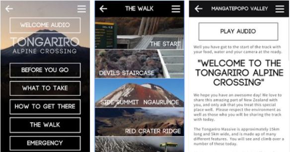
Know Before You Go

If You Don’t Know, Don’t Go…

…Or Go With A Guide


Carry a big stick…

TACAPP

Further on the safety message aspect of this post and the comments, a local crew has just released a new app that comprehensively covers the Tongariro Alpine Crossing and the Mt Ngauruhoe side trail…yes, you have to pay for it – a whole $2.99 – but it is worth it as both a top reference to the walk and as the one stop shop of what you need to know before you set out…

https://play.google.com/store/apps/details?id=com.greattrailsoftheworld.tac

The World According to Me...

…or to paraphrase Theodore Roosevelt “Tread carefully and carry a big stick“…two concepts directly related to my summit of Mt Ngauruhoe yesterday…

SCF9964

This is Stick. Stick is a little miffed that it missed out on going up Mt Tongariro last week, but that’s kinda what happens when you hide away in a dark corner of the garage. Stick is way more useful than lightweight aluminium walking poles which are too flimsy to brace your weight against. Stick is also really good as a counter-balance and a brace when descending scree slopes…

SCF9924-001

Tuesday and yesterday offered the best weather windows for another go at Ngauruhoe; yesterday had the least wind and Tuesday was off the list when I remembered that I had to speak to a visiting Duke of Edinburgh group from Karamu School. The day opening with a beautifully clear sunset that boded well for the day’s adventure.

Mt Ngauruhoe…

View original post 1,607 more words

Clouds | The Daily Post

Write a new post in response to today’s one-word prompt: Clouds.

Source: Clouds | The Daily Post

Mt Ngauruhoe Summit climb April 2016 -015

As the sun climbs, dew on the slopes evaporates and cloud form beneath you. From the summit of Mount Ngauruhoe.

Raurimu-008

Early morning cloud rests in the low lands around Raurimu.

Tongariro Apr 04 - 1

Mount Ruapehu from the Desert Road

Whakapapa-005

Mounts Ngauruhoe and Tongariro taken from the beginning of the Taranaki Falls track in Whakapapa Village.

DSCF8343

Mount Ngauruhoe from the Chateau golf course.

DSCF9856

Cloud forms off the slopes of Mount Ngauruhoe. This is taken from the summit of Mount Tongariro: 15-20 minutes later we were greyed out.

Disaster | The Daily Post

Write a new post in response to today’s one-word prompt.

Source: Disaster | The Daily Post

…sometimes the measure of success is how well you respond…

That was my parting shot in The magnificent seven ride again…, the tale of a 2011 pub crawl against a backdrop of NATO’s Libyan ‘intervention’ and the  lone wolf terrorist attacks by Anders Behring Breivik in Norway in July 2011.

Mt Tongariro Summit Back Route April 2016-013.JPG

Five years later, those are still true words although I see response from a different perspective now…once, response was force projection, rapid deployment, targeting; now response is something we manage every day…

Today’s prompt is disaster…the biggest disaster to hit this region in the last 2000 years was the Taupo eruption around 182-300AD, depending on whose book you read. Of course, if disaster strikes and there is no one there to suffer from it, is it really a disaster or just a large scale natural event..? I mean, we’re talking seriously large scale here: the biggest explosion that the world has experienced in the last two, possibly more, millenia.

When we talk eruptions here, it is always in the context of when, not if: we know that the three volcanoes – Ruapehu, Ngauruhoe and Tongariro – will erupt again. The iffy bits are when exactly and how much…questions that can only be answered after the fact. Predicting eruptions is much like predicting earthquakes: often we can see a shift from what’s considered normal, maybe an increase (or decrease) in gas emissions, a cooling (or warming) of a crater lake, more (or less) volcanic tremors: but what it means is very difficult to determine.

Because prediction is problematic, a lot of resource goes into response. The timelines are pretty tight. A lahar (big volcanic mudslidey thing) coming down the western side of Ruapehu will hit Whakapapa ski field in about 90 seconds…that’s not enough time to check your phone  for directions, call a friend or update your Facebook page about the big black shadow coming down the mountain…part of the disaster response on the ski field is to ensure that people know what to do beforehand…

Further down the the hill, residents of Whakapapa Village have a whole twenty minutes to evacuate everyone from the danger area along the Whakapapanui Stream, essentially the Holiday Park and the housing area across State Highway 48 from the Chateau. Twenty minutes doesn’t sound like much time but after a fortuitous (probably didn’t seem like it at the time) series of false alarms in 2015, Whakapapa residents know they can do this at nine at night, in winter, after dinner and maybe a few beers.

Untitled.png

There may be no warning. An eruption may occur on a beautiful blue sky day, or in the middle of a black, freezing, sleeting, icy night. Luck ran twice when the Te Maare craters erupted in August 2012. Lucky once because an eruption at 11-30PM meant there were no walkers on the Tongariro Alpine Crossing as rocks hammered down onto the track. The biggest of these weighed three tonnes, enough to hurt if it landed on your toes. Lucky twice because, even though it was night, the bunk room at Ketetahi Hut was unoccupied as a rock slammed through the roof.

It’s been many years since we have had a disaster in Ruapehu – some tragedies, yes – but the last real disaster in terms of loss of life and damage was probably Tangiwai in 1953. Once of the reasons that we haven’t had any real disasters since then is our ability to respond. The March 2007 lahar had potential – it was certainly much larger – to be as deadly as its 1953 predecessor : that potential was mitigated, some might say neutered, by a effective well-planned, well-practised response. In fact, between exercises and false alarms, the disaster response was so well-practised that when the main event event occurred, it all seemed a bit boring…

So, when  you visit our maunga, take a moment to read the signs and be aware of what’s happening, what might happen around you…if you’re here for your fifteen minutes of fame, don’t let it be in 5000 years when some alien archaeologist chips you out of the remnants of the great Whakapapa Lahar…

Earth | The Daily Post

Share your vision of our magnificent Earth through your lens.

Source: Earth | The Daily Post

DSCF9880

Red Crater, Tongariro National Park

Yes, I need a camera with a wider angle lens…!

DSCF9985

Tupapakurua Falls Lookout, Erua Forest

DSCF8890

Mounts Tongariro and Ngauruhoe, Tongariro National Park

DSCF0765

Native flax sunset, Tongariro National Park


Carry a big stick…

…or to paraphrase Theodore Roosevelt “Tread carefully and carry a big stick“…two concepts directly related to my summit of Mt Ngauruhoe yesterday…

SCF9964

This is Stick. Stick is a little miffed that it missed out on going up Mt Tongariro last week, but that’s kinda what happens when you hide away in a dark corner of the garage. Stick is way more useful than lightweight aluminium walking poles which are too flimsy to brace your weight against. Stick is also really good as a counter-balance and a brace when descending scree slopes…

SCF9924-001

Tuesday and yesterday offered the best weather windows for another go at Ngauruhoe; yesterday had the least wind and Tuesday was off the list when I remembered that I had to speak to a visiting Duke of Edinburgh group from Karamu School. The day opening with a beautifully clear sunset that boded well for the day’s adventure.

Mt Ngauruhoe (thrower of rocks) is technically ‘only’ a vent on Mt Tongariro but because it is now higher than its parent and such a prominent feature, it is counted as a mountain in its own right. Don’t be fooled however, it is still an active volcano and carries with it, its own unique hazards: it is very steep (a consistent 30 degrees), very smooth and covered in loose rock.

SCF9925

It was pretty brisk at Mangatepopo car park with the normal number of Alpine Crossing walkers milling around. The sky was clear, and the sun beaming down but the temperature was barely above zero…the best way to keep warm: get moving…

Many walkers were way over-dressed and already shedding layers in the first couple of kilometres…a number, by Soda Springs, were already quite oblivious of their surroundings and had to be asked to allow faster walkers past…I don’t really see the point of doing a walk like the Crossing if you are going to zone out before the end of the first leg…

SCF9929

A decent frost crisped up parts of the track lying in the shadow of Mt Tongariro, a good reminder that winter is drawing closer and with it, winter ground conditions. Although there was quite a bit of frost on the board-walks, they weren’t slippery but that won’t be too far away…DSCF9893

I made good time up to the top of the Devil’s Staircase, about 90 minutes. At this sign, turn right…in summer ground conditions, i.e. no snow on the ground, a trail has been worn from the sign towards the base of the volcano.

SCF9963

We’re not kidding!!

Because the sides of Ngauruhoe are so steep and smooth, any rocks knocked loose – and many of the surfaces aren’t that stable to start with – can roll hundreds of metres, picking up a lot of speed along the way. On my way up, I saw two torso-sized boulders crashing down the scree slopes: if they collected anyone on their way down, the results would be serious injury and a free helicopter ride…

SCF9938

As this peters out, a series of blue and orange track markers indicates the route to the beginning of the real climb…

The trick to a safe and successful ascent of Ngauruhoe is to work your way up the solid rock formations, avoiding the scree slopes as much as possible: they are really hard work going up and unstable to such a point that upwards motion, slipping and sliding, will generate lots of mini rock slides.

As a very young volcano, a lot of the rock on Ngauruhoe is very rough and sharp and this is more pronounced the closer to the summit that you get. Hard shell gloves are a good idea – your nice wool Icebreaker gloves will last about five minutes – and I’ll be digging out my leather shooting gloves before I come back up here.

Another incredibly highly recommended piece of kit for Ngauruhoe is a climbing helmet. Unless you are fortunate to strike a day when you have the mountain to yourself (unlikely to occur with decent weather conditions), there is a consistent trickle of small (and not so small) rocks coming down from climbers ahead of you. In addition some of the rock faces on the way up are quite steep with potential drops of a few metres: you may be the best rock scrambler in the world, the that mightn’t help you if you get wiped out by someone less experienced ahead of taking a tumble.

climbing helmet

Something like this…

…and, no, I didn’t wear a helmet myself…something that a. my school group from Karamu School called me on when I caught up with them at Soda Springs on my way back and b. that I intend to do something about before I return…I only saw one group up there with helmets but lots of near misses…

Stick was really useful as a brace on the ascent and there was only one time where I needed to use both hands for climbing…everybody that I saw with walking poles struggled with them: they are too flimsy to be used as a brace and, more often than not, tend to just get in the way: you do need at least one hand free for climbing. I carried a set of poles up for a young American lady who had come expecting a walk not a climb and who was reduced to throwing her poles ahead of her as she used both hands to climb…

This young lady had also been left behind by the rest of her group which is pretty untidy – if you start as a group, you go as a group and finish as a group – more so, when she did not have any water on her. I carry heaps and was happy to share, bolster her confidence and encourage her to the summit but she was not prepared for this sort of activity and was having a pretty miserable time – which defeats the whole point of doing things like this…

SCF9943

It took me about two hours to the summit: spectacular views!! But all that rock is very hard and very sharp with a some big potential drops of the unwary or unsteady of foot..

SCF9948

The top of the cloud was sitting around 1400 metres but all the good stuff was visible, looking here across Red Crater to Blue Lake; lower centre, you can see the Tongariro Alpine Crossing heading up towards its highest point of 1868 metres, and the trail to the summit of Mt Tongariro. climbing off to the left…

SCF9939

There are active vents (fumaroles) on Mt Ngauruhoe and steam was clearly visible from this one on the summit: you can just make it out at four o’clock from the left-hand figure on the skyline…

SCF9949

Without wanting to repeat myself, this volcanic rock is hard and sharp…about three steps into my descent, I slipped and slip a couple of metres and have some nice skin to grow back on my left wrist…slow and steady is the way…

SCF9956

The easiest and safest way to descend Mt Ngauruhoe is down the scree slopes to the west of the rock that you climbed up on. Avoid the rocky surfaces: they are not very stable and you WILL set off rock slides!! Stick to the channels of already disturbed scree where there are less rocks.

SCF9954

Stick was really useful for bracing myself on the scree…this is soft and loose…if you are wearing ankle boots or runners/trainers (really?), gaiters would be a good idea as you will be sinking into this stuff up to and over your ankles. Don’t be an idiot and leap your way down the scree slopes: not only are you kicking loose a lot of loose material that hazards those below you, but if you strike a fixed rock beneath the surface, you are likely to lose your balance and become your own rock slide…you can descend quickly and safely without being an idiot…

Be aware of your surroundings…I spent a lot of my descent time watching behind me for rocks knocked loose by other people…not everyone calls ‘rock’ when they set one loose…think a couple of steps ahead as to where you will go if a rock comes in your direction…

Mt Ngauruhoe Summit climb April 2016 -026

…and finally back on the trail just before the junction with the Alpine Crossing…I was tempted to carry on up to Red Crater, across to Mt Tongariro and come back down the way I went up last week but I didn’t fancy descending down through that cloud on an unmarked trail…

Mt Ngauruhoe Summit climb April 2016 -028

A final shot from just short of Mangatepopo car park…perversely the view was clear with that little cloud rolling in in the time it took me to get out my camera…

Total time was about 6 1/2 hours but that includes a decent break for lunch, assisting the young American lady and stopping to talk to groups along the way. My total walking time, with just breather breaks would have been in the region of 5 1/2 hours…

Insights

  • Gloves – a good set of well-fitting leather gloves will save you skin
  • Helmet – may save your life.
  • Decent sturdy footwear – not runners! Consider gaiters to keep the scree out of your boots/shoes.
  • If you must take walking poles: either take only one of have a backpack that will let you carry them if you don’t need them.
  • Tread carefully: be sure you are stepping onto firm ground before you transfer your weight…
  • Jeans make the climb – and it is a climb not a walk – hard work. I was comfortable in shorts and an Icebreaker T-shirt all day BUT I had good clothing for cold/wet weather on me if I needed it…

BE AWARE OF YOUR SURROUNDINGS – YOUR SAFETY IS YOUR RESPONSIBILITY!!!

It was disappointing to observe the number of people who were physically and psychologically unprepared for Mt Ngauruhoe…many thought it was just a walk and struggled with the climb and the height – one loud American complained the whole way up about his fear of falling – others got up all right but had no idea how to get down…here’s a hint: it’s easy to climb UP the rock; climbing down the same way is not nearly as easy and you’re making people still coming up work around you…

This, I think, puts a lot of the responsibility back onto us locals to ensure that we are setting visitor expectations appropriately in all our contact with them, and through our websites, and social media engagement…Mt Ngauruhoe is not a place where ‘just do it’ is a good or safe philosophy…


Tongariro – the back way

Wow! I haven’t had such a good day on my own for a long time…

I have two weeks off to consume accumulated public holidays and time in lieu…with three days of fine weather forecast this week, normally I’d be working on the Lodge but this week I’m letting my muse drive me…

Today – and I am trying to write this while the memories are fresh and before I face-plant the keyboard as I am  just a little jaded – to venture up the ‘alternate’ route up to Mt Tongariro from Mangatepopo, across to Red Crater and then back down the Crossing trail to Mangatepopo. It’s probably a by-product of my green journey and its muse that I feel attracted back to the outdoor environment; that, and wanting to get some me time away from people ( natural enough when you work with hundreds of visitors every day).

An early start to make sure I could get a park at or near the Mangatepopo car and I was legging it towards Mangatepopo Hut by 7-30. No pix of the car park: although it wasn’t nearly as chaotic as it can be there were still heaps of people milling around and I just wanted to get underway.

The hut is only about fifteen minuets from the car park. I made a quick stop there to enter my trip into the hut book – you can never be too careful – and away I went…

DSCF9841

Mangatepopo Hut

There is quite a well-formed track that heads off north-eastish from the hut down to the stream. Some parts of the track towards the stream are quite heavily eroded and you need to be a little careful especially when it is a bit damp/slippery, as some of gouges are a metre or so deep. I followed that across the stream and up the opposite slope where the track is still pretty clear. From the sign it is fairly well-used.

DSCF9849

Target for today: Mount Tongariro

The climb up is pretty easy but already the day was warming up well past the forecast 0-5 degrees.

DSCF9852

I had dressed for the the forecast and was already feeling a tad warm so converted my trousers into ‘shorts’ with some judicious folding. Much more comfortable.

DSCF9845

It looks pretty but…

Why do people persist in build cairns in the Park, especially things like that that are purely decorative? Do they not get that it is a national park and the whole is to do no harm. The environment here is very delicate and even moving one rock exposes fresh soil to the elements and leads to the erosion that already devastates parts of the Park.

DSCF9850

Oh, great, people!!!

I was looking forward to some quiet introspection time so the sight of a group following me up was not welcome. I stopped to let them pass me but we ended up pacing each other and then travelling together. They were a group of Duke of Edinburgh students from Thames High School whose objective this week was four summits in four days. They’d missed out on Ruapehu two days previously as the weather had closed in and they’d decided to pull the pin – good move – but had summitted Taranaki and Ngauruhoe successfully.

DSCF9853

The lava flows from the more recent eruptions on Mt Ngauruhoe are very clear from across the valley. When (not if) Ngauruhoe erupts again, the historical lava route has been down the north-western slopes and we’ll need an alternative route like the one I walked today to keep the Tongariro Alpine Crossing open.

You can also see cloud forming off Ngauruhoe as the morning sun evaporates dew off the rocks. The same thing was happening on the other side as we walked up. Many people are surprised by just how quickly cloud can form up here and how thick it can be. As people found once we were on the summit, when the cloud is so thick that you can see the trail properly, the best thing to do is just sit it out.

DSCF9857

How erosion starts 101

I encountered a number of gouges in the surface like this as I climbed further up. There were clearly man-made as some of them ran perpendicular to the flow of water off the slopes. Some of them looked like campers had carved out a little drain to divert water around their campsite; others looked like rocks had been rolled or dragged down the slope. The surface up here is that delicate that interference like this will channel rainwater and cause serious erosion in a very short time.

There is not a trail all the way to the summit but the route is fairly intuitive with only one significant scree slope just below the summit. The trick is to aim slightly left as you approach the peak and this will take to directly to the summit. The climb itself is pretty Goldilocks: not so long that you get into ‘are we there yet?’ syndrome but not so short that you don’t feel like you haven’t done any work. Cresting the summit is really “OMG, we’re here!!”

DSCF9863

Thames High DofE group


DSCF9864

The cloud closed in as soon as we reached the summit…

…restricting views to just the top of Ngauruhoe.

DSCF9861

Lunch

Lunch for me was one of my bannofee smoothies and a couple of Jen Rice’s chewy apple spiced cookies – Jen says that two of these cookies are a meal and she is absolutely right: even after walking for three hours, two were more than enough to fill me up. I would have brought one of her turmeric coconut and pineapple smoothies except I’m out of pineapple until my next trip to civilisation.

DSCF9867

As I finished my lunch the cloud closed right in…while we waited for it to clear as it usually does relatively soon, I enjoyed talking with other waiting walkers about the Park, Lord of the Rings – always a safe subject – and the volcanoes.

DSCF9866

A minute ago this was all cloud

Even quicker than it had appeared, the cloud disappeared and it was off down the marked trail to Red Crater

DSCF9882

Skirting around the rim of South Crater down to Red Crater…

DSCF9880

Looking down into Red Crater

Most Crossing walkers had already passed this point so I didn’t encounter too much traffic in the other direction heading down towards South Crater

DSCF9885

Enter a caption

A late walker heading up to Red Crater…the route is quite steep and uneven but easily negotiable in either direction so long as walkers take care and watch their foot placement.DSCF9887

Looking back across South Crater: the route up to Red Crater runs about halfway up the ridge line that runs out the left edge of the image…

DSCF9896

Looking down from the top of the Devil’s Staircase, over Soda Springs to the beginning of the Crossing. Mangatepopo Hut can just be made out centre left. The route down the Staircase is quite windy but easily negotiated at speed over most of its distance.

DSCF9904

From Soda Springs to the hut is very flat with many ‘highway’ quality board walks. I always hate this leg as it is, IMHO, quite boring and rather administrative in nature.

Today was the first time that I have been out in the Park for a couple of months. Although the solitude was not as I expected, I enjoyed meeting and talking with other walkers and exploring a path less travelled.

DSCF9856

Target for tomorrow..?

That will probably depend on whether I can get out of bed in the morning…some joints are having a bit of a bitch tonight…

Ridge Track, Whakapapa Village

The Ridge Track is a nice short – about twenty minutes/1.2km each way – walk right in Whakapapa Village…great for a quick leg stretch at lunchtime…

DSCF8850

It starts here at the public shelter, just up the road from the DOC Visitor Centre, and opposite the Whakapapa Holiday Park. The trail itself is just up from the shelter , where you can see the DOC sign on the right of the picture…

DSCF8849

The trail winds behind the shelter…

DSCF8848

…across the bridge and into the forest…

DSCF8847

…past a nice resting spot about halfway up (the forested part)…

DSCF8846

…before you break out into the open and continue up through the tussock.

DSCF8845

Not all of the trail is in tiptop condition and sections like this can be a little more challenging, especially after a good downpour…

DSCF8843

…and your’re there…

DSCF8844

No one is quite sure why there is a big table here but there is…be nice ofr a picnic, better if there were seats…

DSCF8838

Further up the ridge line, on a clearish day, you can often see the very top of Mount Ruapehu…

DSCF8839

…to the north, there are often great views of Mount Ngauruhoe and Mount Tongariro…

DSCF8841

…and below, The Chateau and Whakapapa Village, with SH48 winding back down towards SH47 and civilisation…

Tea and Pikelets at Waihohonu

A change is as good as a holiday, so they say…and I leapt at the chance to get out of the office to check on internet connections in the huts on the Northern Circuit.

My day didn’t get off to the smoothest of starts…

DSCF9332

Naughty Meindls

…my trusty Meindls tossing a lace…already running a tad late, I grabbed…

DSCF9333

Good Meindls

…my spare never-before worn pair…the beauty of Meindls being that you really can wear them right out of the box…

DSCF9322

Looking east towards Red Crater, Mount Ngauruhoe on the right

It doesn’t look like the cheeriest of days but it was actually a great day for walking, a nice westerly to take the edge off and keep us cool, and just enough sun to be pleasant without being scorching…

DSCF9321

First stop was Mangatepopo, only about twenty minutes walk in from the car park…a nice cuppa with the ranger there…

DSCF9324

…before some comparative performance testing on laptops, tablets and phones…

DSCF9330

Lured by the promise of pikelets for smoko, we headed off for the other side of Mount Ngauruhoe and Waihohonu Hut…Parking up at the Waihohonu Road End park we made good time into the hut. The surface is mostly sandy, firm enough to walk on but not so compacted as to be uncomfortable…

DSCF9326

While we did our techo-geeky stuff…

DSCF9329

…the chef started on smoko…

DSCF9325

Who says you can’t have the comforts of home in a back country hut..?

DSCF9328

As you can guess from the pix, Waihohonu is quite new and very comfortable…

DSCF9330

Seeing the cloud spilling over Ngauruhoe, we decided on a more cracking pace back to the park, completing the last klick or so at an enjoyable jog…

I’m regretting not filling the spa a couple of weeks ago as a nice soak would go down pretty well at the moment…I suspect that I may be a little stiff in the morning…a most excellent day and one I hope to repeat next week as Oturere still needs testing….