Wow! I haven’t had such a good day on my own for a long time…
I have two weeks off to consume accumulated public holidays and time in lieu…with three days of fine weather forecast this week, normally I’d be working on the Lodge but this week I’m letting my muse drive me…
Today – and I am trying to write this while the memories are fresh and before I face-plant the keyboard as I am just a little jaded – to venture up the ‘alternate’ route up to Mt Tongariro from Mangatepopo, across to Red Crater and then back down the Crossing trail to Mangatepopo. It’s probably a by-product of my green journey and its muse that I feel attracted back to the outdoor environment; that, and wanting to get some me time away from people ( natural enough when you work with hundreds of visitors every day).
An early start to make sure I could get a park at or near the Mangatepopo car and I was legging it towards Mangatepopo Hut by 7-30. No pix of the car park: although it wasn’t nearly as chaotic as it can be there were still heaps of people milling around and I just wanted to get underway.
The hut is only about fifteen minuets from the car park. I made a quick stop there to enter my trip into the hut book – you can never be too careful – and away I went…

Mangatepopo Hut
There is quite a well-formed track that heads off north-eastish from the hut down to the stream. Some parts of the track towards the stream are quite heavily eroded and you need to be a little careful especially when it is a bit damp/slippery, as some of gouges are a metre or so deep. I followed that across the stream and up the opposite slope where the track is still pretty clear. From the sign it is fairly well-used.
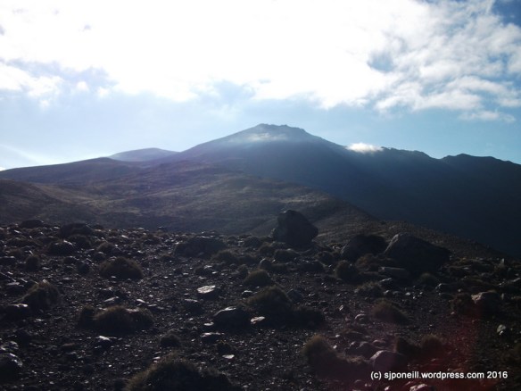
Target for today: Mount Tongariro
The climb up is pretty easy but already the day was warming up well past the forecast 0-5 degrees.
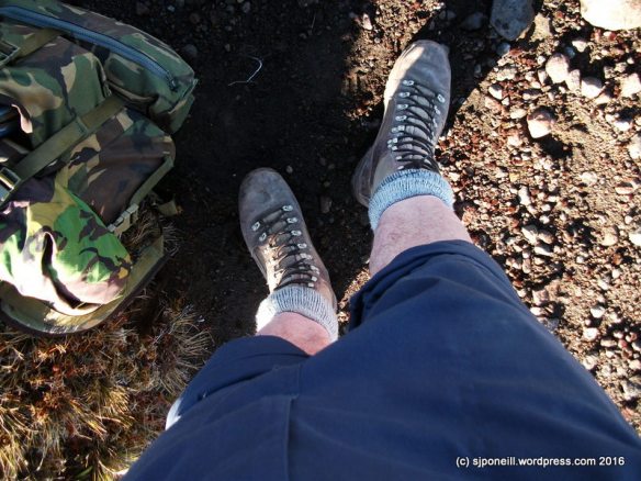
I had dressed for the the forecast and was already feeling a tad warm so converted my trousers into ‘shorts’ with some judicious folding. Much more comfortable.
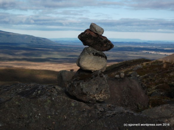
It looks pretty but…
Why do people persist in build cairns in the Park, especially things like that that are purely decorative? Do they not get that it is a national park and the whole is to do no harm. The environment here is very delicate and even moving one rock exposes fresh soil to the elements and leads to the erosion that already devastates parts of the Park.
Oh, great, people!!!
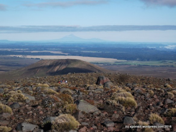
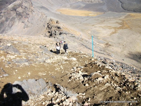
I was looking forward to some quiet introspection time so the sight of a group following me up was not welcome. I stopped to let them pass me but we ended up pacing each other and then travelling together. They were a group of Duke of Edinburgh students from Thames High School whose objective this week was four summits in four days. They’d missed out on Ruapehu two days previously as the weather had closed in and they’d decided to pull the pin – good move – but had summitted Taranaki and Ngauruhoe successfully.
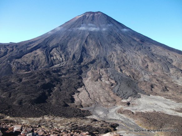
The lava flows from the more recent eruptions on Mt Ngauruhoe are very clear from across the valley. When (not if) Ngauruhoe erupts again, the historical lava route has been down the north-western slopes and we’ll need an alternative route like the one I walked today to keep the Tongariro Alpine Crossing open.
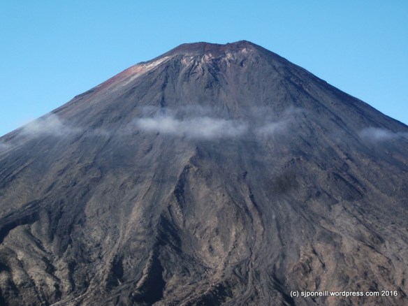
You can also see cloud forming off Ngauruhoe as the morning sun evaporates dew off the rocks. The same thing was happening on the other side as we walked up. Many people are surprised by just how quickly cloud can form up here and how thick it can be. As people found once we were on the summit, when the cloud is so thick that you can see the trail properly, the best thing to do is just sit it out.

How erosion starts 101
I encountered a number of gouges in the surface like this as I climbed further up. There were clearly man-made as some of them ran perpendicular to the flow of water off the slopes. Some of them looked like campers had carved out a little drain to divert water around their campsite; others looked like rocks had been rolled or dragged down the slope. The surface up here is that delicate that interference like this will channel rainwater and cause serious erosion in a very short time.
There is not a trail all the way to the summit but the route is fairly intuitive with only one significant scree slope just below the summit. The trick is to aim slightly left as you approach the peak and this will take to directly to the summit. The climb itself is pretty Goldilocks: not so long that you get into ‘are we there yet?’ syndrome but not so short that you don’t feel like you haven’t done any work. Cresting the summit is really “OMG, we’re here!!”

Thames High DofE group

The cloud closed in as soon as we reached the summit…
…restricting views to just the top of Ngauruhoe.

Lunch
Lunch for me was one of my bannofee smoothies and a couple of Jen Rice’s chewy apple spiced cookies – Jen says that two of these cookies are a meal and she is absolutely right: even after walking for three hours, two were more than enough to fill me up. I would have brought one of her turmeric coconut and pineapple smoothies except I’m out of pineapple until my next trip to civilisation.

As I finished my lunch the cloud closed right in…while we waited for it to clear as it usually does relatively soon, I enjoyed talking with other waiting walkers about the Park, Lord of the Rings – always a safe subject – and the volcanoes.

A minute ago this was all cloud
Even quicker than it had appeared, the cloud disappeared and it was off down the marked trail to Red Crater
Skirting around the rim of South Crater down to Red Crater…

Looking down into Red Crater
Most Crossing walkers had already passed this point so I didn’t encounter too much traffic in the other direction heading down towards South Crater

Enter a caption
A late walker heading up to Red Crater…the route is quite steep and uneven but easily negotiable in either direction so long as walkers take care and watch their foot placement.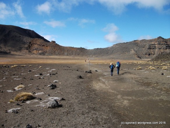
Looking back across South Crater: the route up to Red Crater runs about halfway up the ridge line that runs out the left edge of the image…

Looking down from the top of the Devil’s Staircase, over Soda Springs to the beginning of the Crossing. Mangatepopo Hut can just be made out centre left. The route down the Staircase is quite windy but easily negotiated at speed over most of its distance.

From Soda Springs to the hut is very flat with many ‘highway’ quality board walks. I always hate this leg as it is, IMHO, quite boring and rather administrative in nature.
Today was the first time that I have been out in the Park for a couple of months. Although the solitude was not as I expected, I enjoyed meeting and talking with other walkers and exploring a path less travelled.
Target for tomorrow..?
That will probably depend on whether I can get out of bed in the morning…some joints are having a bit of a bitch tonight…


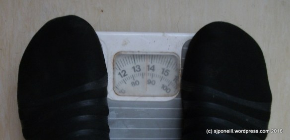 So there is life below 90kg…


