
 Zone 1 of the Waiouru Military Training Area is one place that I never thought I would find myself again…
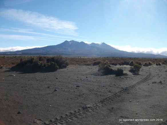
Zone 1 is one of about three dozen zones that the New Zealand Army’s main training area is divided into; it extends from State Highway 1 to the eastern slopes of Mt Ruapehu and provides an open country manoeuvre and live firing area for Army units. It has been used for live firing since the early 20th Century, in the days before unexploded munitions were tracked and recorded and thus remains an area closed to the public – unless escorted by Army staff.
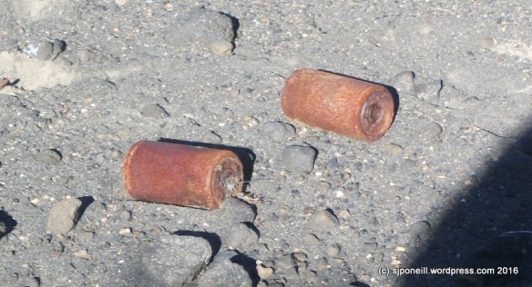
Hazards…if you don’t know, don’t touch it…these are each the size of a can of baked beans…do you know what they are..?
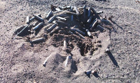
…possibly safe…but what lies beneath…

…shiny…don’t touch…
One of its claims to fame is that it starred as Mordor in many scenes from Peter Jackson’s Lord of the Rings trilogy, mainly Return of the King, including the physical Black Gates at the entrance to Mordor and the final battles that concluded the saga. Mt Ngauruhoe lies physically in about the same relation to Zone 1 as Mt Doom did in relation to the Gates.
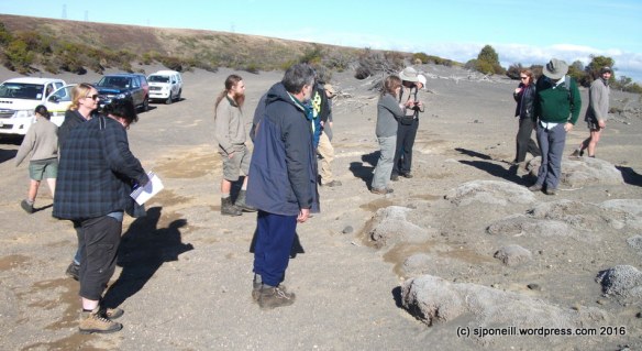
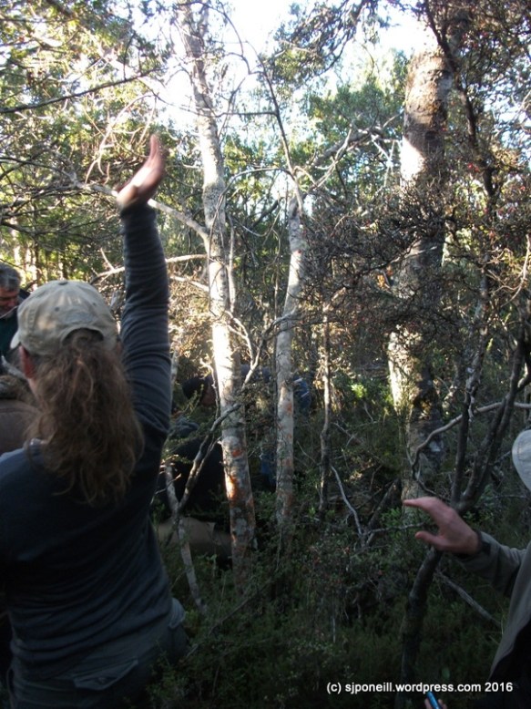
Today I was fortunate to have been invited to attend a seminar to discuss the volcanic dunes in the Rangipo Desert, with a series of research-based presentations followed by a field trip into Zone 1 to view the dune environment directly. Our group was admirably hosted by the Army – very good to renew my acquaintance with Major Pat Hibbs who I’ve known since my days as a very young soldier in 2/1 RNZIR – firstly at the National Army Museum, and then our escort as we forayed into the desert.
The four presentations at the Museum set the scene for our diverse group and provided a valuable opportunity to either clarify or raise any questions before we set out:
Graeme La Cock – a synthesis of information on the volcanic dunes of the Rangipo Dunefield
Harry Keys – disturbance role of lahars and eruptions, Japanese research interest generally and revegetation issues, including the disturbed area near SH1 and the bund.
Mark Smale – The age, vegetation and formation of the volcanic dunes
Angelina Smith – The impact of vehicles on the Rangipo Desert, and suggestions to mitigate these impacts.
What did I learn…
Lots…first to remember a pen and paper next time to write it all down…I’ve deliberately left out all the scientific terms because my memory just wasn’t up to remembering it all but I may rewrite this if the morning’s presentations are shared and OK’d for release.
Many agencies cooperate and share research on the dune fields. These include the Department of Conservation, NZ Army, Landcare Research, The University of Waikato and Massey University. In addition, overseas researchers also conduct and share studies on the volcanic dune fields.
Volcanic dune fields are very rare, existing only in Iceland, Peru, the coast of California, Indonesia and New Zealand. Although there are other inland dune fields in New Zealand, the only volcanic dune field is at Rangipo.
The Rangipo Desert isn’t really a desert: it has too much rain…the annual rainfall in Waiouru is around 1200mm, and on Mt Ruapehu around 2400mm, actually quite wet by New Zealand standards and certainly well above that for any definition of desert to stand.
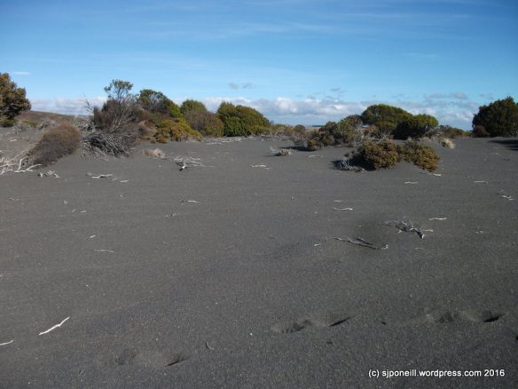
If not technically a desert – even though it may appear like one to the untrained eye i.e. lots of sand – it most definitely does qualify as a dune field, basically an area of shifting sands forming terrain features.
It is not considered that the military use of the area over the last 100 years has affected it one way or another. Although Zone 1 has been and still is used as an impact area for artillery, bombs and rockets, and is a manoeuvre area for armoured vehicles ranging from 17 tonnes (NZLAV) to 50 tons (Centurion) it does not appear any different visually from the adjacent section of the dune field that lies within Tongariro National Park. The theory is that the whole area i.e. the surface, is so unstable anyway that the impacts of shells and vehicles is actually negligible compared to the effects of wind and rain, snow and ice.
Because the dunes are constantly changing it is very difficult to measure their age. This is complicated in Zone 1 because the very real risk of buried unexploded munitions prevents digging and core-sampling. One of the recent studies found that the best way to tell the age of a dune is by measuring the age of the vegetation on it…

Some of the more mature trees in the dune field although only 3-4 metres high, and 3-400 years old
The event that has had the most impact on the Rangipo area was the Taupo eruption some time between 182 and 250AD. It is not really known what this area was like before this eruption but it was certainly scoured clear of vegetation as a result. Since that event, man-made fire has probably been the biggest impactor on the state of the dune field, with periodic large lahars, on average about every 500 years or so, having the next most impact.
The dunefield is slowly expanding north and no one is quite sure why …
The dune field is a rugged challenging one for plant life and there is a clear succession that starts with growths like this…

…around which the sand drifts and builds up. simple grasses like bristle tussock may then develop followed slowly, often over years or decades by more complex vegetation.
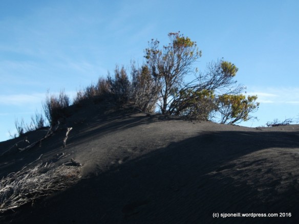
It is a harsh unforgiving process…as dunes the surface is constantly shifting: the risk to developing vegetation is that it may be simply buried under the shifting sands, or have the sand around it uncut, exposing its roots…

…either way not good for ongoing survival…
Even though there are substantial beech forests only a few kilometres away, the beech forest will probably not regenerate in the dune field because a fungus necessary to its growth is not in the soil there and is very difficult – read, close to impossible – to establish artificially.
The desired future for the Rangipo dune field is for it to regenerate naturally i.e. to its pre-settlement state. Replanting is not considered necessary, more a tool of last resort and it is considered of greater benefit to focus conservation efforts on the control of invasive weeds and pest animals like deer, rabbits, hares and possums.
The Army conducts its own pest control programmes across the Training Area, all 63,000 hectares of it, targeting pests like possums, rabbits and hares, and invasive weeds like the various forms of weed pines. Because the Area has an 85% usage rate – there were only three days this month in which we were able to get into Zone 1 for this study trip – and due to the number of hazards on and under the ground, much of this work is done by helicopter. As a part of this programme, the Army is also investigating source vectors for invasive weeds and sharing the results of this work.

Smoko and networking
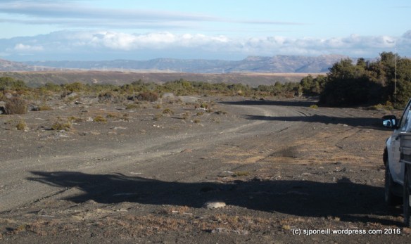
The road home…
In another life, I trudged all over the dunes ‘by day and by night, regardless of season, weather or terrain’…environmentally then, my main concern was the fine grit that, when wet, would stick to everything…one particle being all it took to convert rifle into not much more than a blunt instrument…none of us back then had any notion of the rarity, vulnerability or real harshness of this unique environment…I’m glad of this one last wander in my old stamping grounds…


Very interesting Simon. I spent some weeks in the late 1950s .One warning we were given was never to build trenches each night across tracks otherwise the horses would likely disrupt your sleep.Am enjoying your other blogs. Dad
LikeLike
Pingback: Hot stuff | The World According to Me…