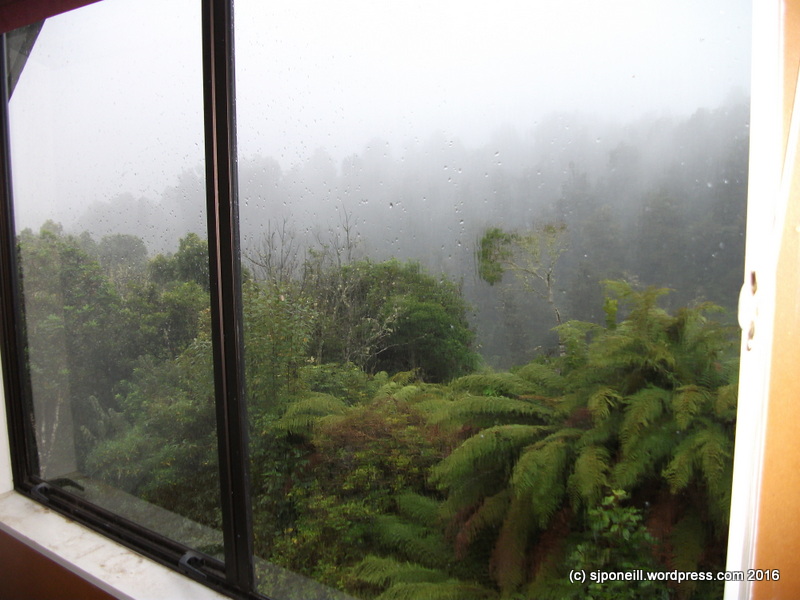
Not very “springy”…cold and wet…not much interest for anyone in doing much outdoors today…stay in and be warm…sadly the beginning of the last weekend of the school holidays…
After 14 road deaths in the last fortnight, with this weather, people will be taking the discretion option and heading away a little earlier, avoiding the logjam of Saturday and Sunday…
The Challenge
Mental Health Awareness Week in New Zealand is 9-15 October this year. Each year, the Mental Health Foundation of New Zealand runs and sponsors a number of awareness activities.
…what would I say to any one venturing into Tongariro National Park for a day walk or an overnighter..? I had been thinking about writing something like this after my Brutal post yesterday but this comment on my Carry a Big Stick post from my last excursion up Mt Ngauruhoe pretty much made the decision for me (thanks, Rob!)…
I would start with the weather. I would say to only check the Metservice forecast for Tongariro National Park. There may be other sites and apps that may tell you want to want to hear but only Metservice has trained meteorologists in the analytical loop. The Metservice forecast for the park is only for five days: three in detail for Whakapapa Village at 1135m and Red Crater at 1868m; the last two days in outline.
Snow in December
Updates are issued each day around 7-30AM and around midday: each update may be quite different from the forecast it replaces. Do not expect the actual weather to always conform to the letter of the forecast. In the end it is your decision to carry on: if you think the conditions are taking you outside your comfort zone (perhaps too hot, too cold, too windy, too wet, too slippery i.e. icy, too cloudy, etc) stop and think about what you are doing and review your options…
The weather here is very changeable so sometimes even the five day forecast is subject the swings of extreme: unlike the South Island which has long mountain ranges that keep the weather pattern relatively stable, our weather can not only switch just like that but can also manifest itself as radically different micro-climates in close proximity to each other..a couple of years back, two inches of hail were dumped at Mangatepopo without even darkening the blue skies over Whakapapa Village…
Regardless of the forecast, be prepared for four season in one day: a good thermal layer and a good wind- and rain-proof layer, gloves and beanie but also sun hat, sunglasses and sunblock; good walking shoes or boots – not jandals or heels; enough water, at least 1.5 litres, for the day and enough food for the day: good snacky energy food…
So what if something happens…?
In New Zealand, cell phone coverage generally follows the highways : Tongariro National Park is sandwiched between four highways and enjoys reasonable but NOT PERFECT coverage – a lot may depend on the specific model of phone and your service provider – if you need assistance, for example, you are lost, injured or assisting someone else, dial 111 and ask for Police – in New Zealand, the Police are responsible for all off-road rescues. Even if it is an injury: if you are off the road, ask for the Police!!
Three safety questions
Regardless of whether you are going out for a day or overnight, there are three questions you need to ask yourself:
Does someone I trust know what my detailed plans are? Contrary to some myths, this does not have to be someone in New Zealand. It is better that it is someone you trust at home than some bloke you met the night before in the backpackers.
Does this person know when I will contact them after the walk to say I am OK? Ideally this would be no later than the night you finish the walk. If your trusted person is overseas, be very clear about whose time zone it is that you will contact them.
Does this person know who to call if I do not return? If they are in New Zealand, they should dial 111, ask for police and say that they have a friend or family member in Tongariro National Park on the XXXX walk, that you did not contact them when expected and that they are unable to contact them. Information that it is good for your trusted person to have ready to pass onto the Police:
Your DOC booking number if you are booked into one of the huts or campsites. If you are just on a day walk, where are you staying that night?
Your car registration number. This allows Police to check cars parked around the Park and also to check to see if you may have left the Park and then been involved in an accident somewhere else.
Your cell number – written out not just as a number in an address book: for when the Police ask for the number.
Your Personal Locator Beacon ID number, if you have one. If you do not, especially if travelling on your own, a PLB can be rented for about $10 from various locations around the Park.
Any medical history you or anyone in your group may have that may affect your ability to complete the walk and/or that may be useful for a search party to know.
It is quite important that your trusted person does not fall into the trap of ‘Oh, I’ll just give it another couple of hours’ or ‘I’m sure they’re OK, I’ll call in the morning‘. If they do not hear from you when they expect to and cannot contact you they should make the call.
If your trusted person does not speak good English, it is a good idea for you or them to write down what they want to say in English so they can just read it out (www.translate.com is your friend)
If you are the trusted person for someone, don’t waste time playing amateur detective trying to find someone. Under New Zealand law, companies and agencies cannot release information on who may be booked with them or not. All you are doing is wasting time – call the Police and let them do this.
New Zealand is a beautiful place and we all want everyone to come here to enjoy it but…
We don’t close things if they might be unsafe: we rely on visitors to make informed decisions against their own experience and equipment. If in doubt don’t…
Don’t believe everything you read on Facebook or hear in the backpackers about what is or is not doable…
Take responsibility for your safety and that of your friends and family…
Have a Plan B…and C and probably D…
There is no view worth a free helicopter ride…
…it’s not actually free…these cost a lot of money to maintain and operate…
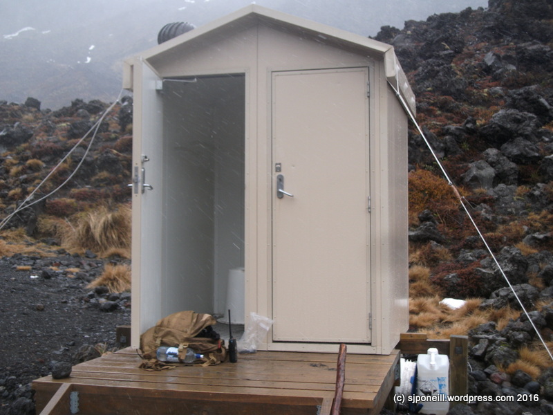
My temporary office/shelter at Soda Springs, about 1200m ASL
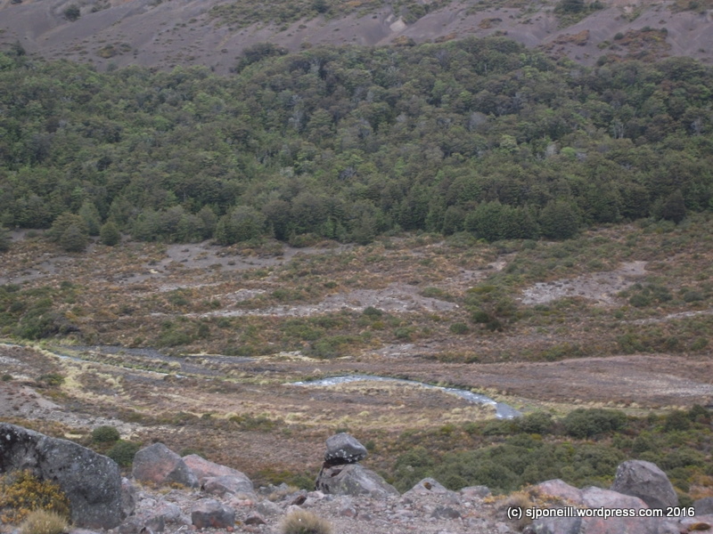
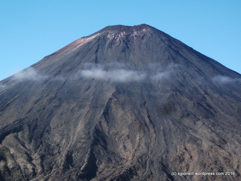
A few weeks back, work was pretty slow, so I decided to go for a walk up to Red Crater to check the ground conditions: even though the rest of the country might have been enjoying Spring, Tongariro weather is always changeable and even now, almost into December, the forecast promises gale force winds and snow to low levels…
The original forecast for my day in the Park looked quite nice but turned for the worse overnight…I almost gave it a miss but decided to go up to see how many people also decided to venture into the mess…I’m always interested to learn where our visitors get their information from and what decision process they apply (or perhaps not) when deciding to venture out into the Park when the weather is less than its best.
The first leg up to Soda Springs was quite pleasant, drizzly but not really cold and just a light wind. I made good time as there were only a very few people on the trail – a stark change from the ant farm of a decent weather day…a few hundred metres short of the Springs, there was a distinct temperature gradient and the light drizzle changed into a quite brutal sleet shower: not pleasant at all. It was clearly snowing further up and I didn’t see much point pressing on…
A guided group preparing to head further up the trail – going with a guide in these conditions adds an extra layer of safety
A group of three that I had passed on my way up stopped for a chat. They had checked the forecast before departing but were unaware that the first morning update comes though about 7-30. The previous forecast had been for nicer weather and improving as the day progressed: the guy leading them had fixated on this improvement and was expecting this to happen as they worked their way up the Crossing. One of the girls only had a light jacket and was only wearing tight-fitting track pants: it wasn’t hard to see the early signs of hypothermia…dragging feet, slurred speech, diminished motor control…. I suggested that perhaps they might to turn back and get her dried off and warmed up…
I walked back with them to make sure they made it back alright. The guy, Eric, was quite a good bloke and we chatted on that walk back: Chinese, he had attended high school in Hamilton and had considered himself reasonably experienced in the New Zealand bush: many weekends he and his fellow boarders had been dispatched on bush tramps and walks. He was quite annoyed that no one at the lodge they were staying at had warned them about the weather or told them to wait until the morning update before checking the weather.
As we descended towards Mangatepopo car park, and away from that temperature gradient, the weather warmed up and Eric’s friend improved along the way. Misinformation about conditions and hazards in Tongariro National Park is common. Where information does exist it is more often of a tourism promotion ‘happy happy joy joy‘ nature and less of the simple easy to understand bullet points that should be shaping visitor expectations from the time they first consider visiting New Zealand.
All’s well that ends well and Eric and his friends came in the next day to say thank you for the assist.That notwithstanding, there have been some gnarly rescues in this area of the Park, most of which have been caused by the rescuees’ aspirations getting a head of their capabilities…
Plans for dinner last night didn’t start so well…I was a bit unsure about the meat that I had thawed out during the day so the dogs got a treat for dinner…
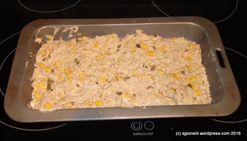
Jen Rice’s Beer And Jalapeno Cornbread – Sugar Soil was already a contender and I had bought some jalapeños and chillies on my way back from the Rangipo Dune Field on Monday evening…I had thought that I had bought a couple of cans of Guiness for cooking purposes previously but couldn’t find them anywhere so went with this instead…
The recipe is quite simple, not much more than mix all the ingredients and bake in a greased pan, so I won’t repeat it here unless I end up changing it at all.
Almost ready for the oven
With the butter drizzled over the top before baking – not sure this was a good idea…
It was quite delish though and I was sorely stretched to wait for the recommended 30 minute cool down period before removing it from the pan and slicing the first slice off…the combined aroma of fresh bread and jalapeño wafting out of the kitchen was irresistible…
Even small slices like these are very filling but I need to think some more on where this might fit on the health scale…probably about midway as there is nothing inherently unhealthy in it, i.e. no sugar but it is three cups of white flower (although I could have added some bran had I thought about it) plus the beer. I used bottled jalapeños and canned corn: I’d prefer fresh next time if I can find some…
The top crust is quite crumbly, possibly due to the butter drizzled over the top before baking. Next time, like, probably tonight, I may try this again but deleting the beer and just putting it through the breadmaker. I think this may give me a denser loaf and less wastage from crumbing – this is too good to waste one speck!!
Have created this, I was a bit lost as to what to have with it and took the lazy option of a can of soup from the pantry – there is probably a reason that it was on special: the only reason that I would buy soup…it wasn’t very nice: well, certainly not a shade on our home-made soups. I tried a spice of jalapeño bread toasted with butter this morning and that was very nice – only later did I remember that I have some dipping sauces in the pantry that I bought because I liked the containers…
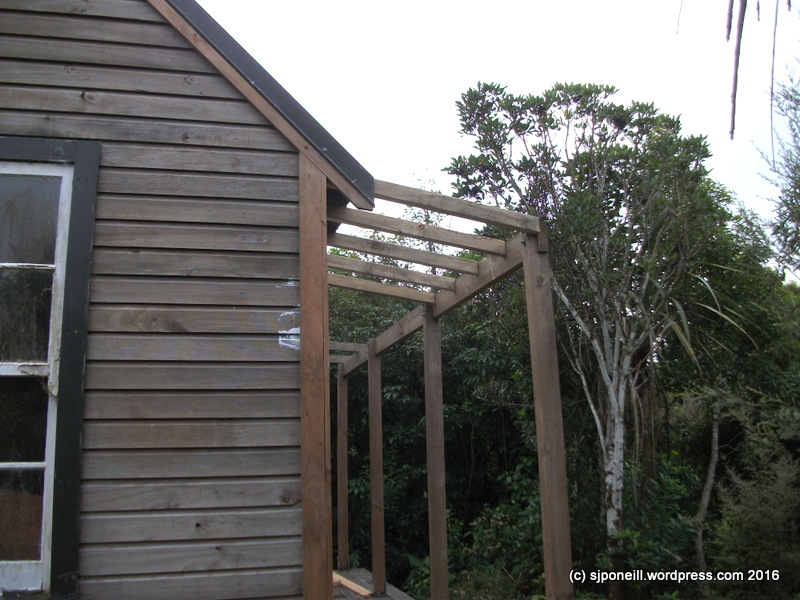
I can’t complain as I’ve had a really good break with the weather while I have been consuming some leave – having the truck (still) at the ‘doctors’ has been a bit of a limiting factor as the courtesy car they gave me is way thirsty than the mighty Ssangyong and it’s only intended for local running – but it is a bit of a crappy day today so there go my intentions to finish off the framing for the roof over the deck on the cottage…
I made a good start yesterday…it’s not a particularly complex task but made all the more difficult because the design that I inherited in this thing isn’t the greatest and the original construction leaves a lot to be desired: almost nothing is square and the builders took a lot of shortcuts. The spacing on the original roof supports over the deck was only a few cm less than the 660mm width of the supplied roofing iron so my first attempt had to be taken down and redone at 400mmm spacing…
….so insidey jobs today…more cleaning…updating my paper model database and more progressing on this beast…
It’s not really as chaotic as it looks…just want to get all the foam-reinforced parts ready for sanding (outside) once we get some nice weather again…
…most of the larger sub-assemblies are done…
Just debating whether the day deserves a fire or not…
Clouds can form at many different altitudes. They can be as high as 12 miles above sea level or as low as the ground. Fog is a kind of cloud that touches the ground. ~ SciJinks
These one word prompts from WordPress always strike me as quite lazy: if the muses can’t be bothered putting any effort into the prompt, I feel less inspired to apply myself to any response…all too often my response is graphic (graphic imagery-wise, not graphic colourful in the semantic sense!) but while I am set-a-foot for the next week or so, I’m determined to write something once a day, even if it is not in response to that day’s prompt….
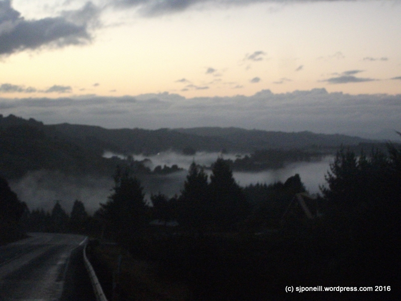
Fog here, just is…it is more common than not in the morning, often beautifully so, filling in the low ground and giving rise to impressions of great inland lakes, around which the road skirts – or sometimes descends into…
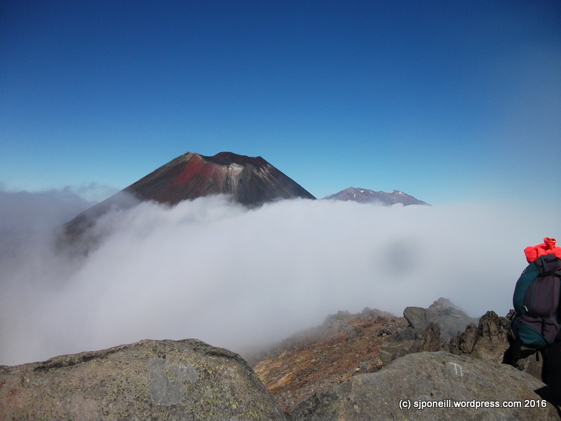
On the mountains, it is common for fog to form rapidly, catching out the unwary walker or climber. Often visibility will deteriorate to a point where the next marker pole on a track is no longer visible; or the landmark you are using as a point of reference of exploring off-trail just disappears…
It is actually quite cool to be sitting up high and watching clouds and fog form in front of you, or below you…often around mid-morning as the sun burns off dew on the rocks from the previous night, the water vapour created will only rise a few metres and then drift off, slowly (sometimes not too slowly) thickening into a thick mist…
Sometimes it is only a matter of minutes before clear skies are obscured, and navigation is hindered + it is cold in the cloud as well: another trap for the unwary…
…and from there to here, on the summit of Mount Tongariro, where walkers are wisely waiting for the fog to clear enough for the poles marking the trail back to Red Crater to be visible again…it normally doesn’t take too long…best to wait than to wander off and find you cannot see any sign of civilisation when the fog clears..!
My first thought for saturated was colors but while we have green all around us here, it does not feel like we are saturated in green; my next thought was food-related but saturation and food often lead to fun-killing conversations…I was going to give ‘saturated’ a miss until I went for a drive yesterday.
Normally when it is stormy and wet, I drive south down SH1 as SH4 through the Paraparas is prone to closure in bad weather. Yesterday morning I was too engrossed in my Audible book (it wasn’t even that good!) and missed the ‘Kune turn-off (no eclairs for smoko). Fortunately by midmorning, the crews were already well into slicing and dicing the trees that had fallen across the road, and clearing away some minor slips.
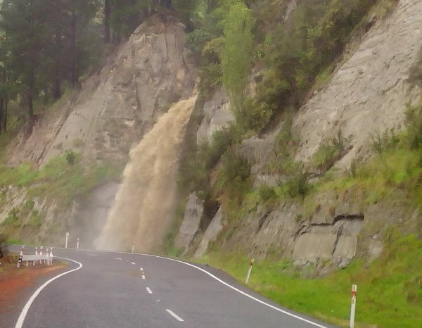
What got me thinking along saturation lines were a number of uncharacteristic waterfalls torrenting onto the roadside – not something that you would normally see and a sign of how saturated the ground further up must be.
This was the only one that was anywhere that I could safely pull over and take pictures – much of the road is quite narrow with high cliffs on one side and steep drops on the other. Descending into Wanganui and droving along the river, it was easy to tell just how much water must have been dumped into the catchment over the last day or so…