So here we are….only the fourth of March, with only two really summery days all year (a really summery day being one where it feels too hot to do anything), and already we have had our first snow for 2014…I guess the ‘crust’ on the water in the wheelbarrow from yesterday’s rain and the brittle white grass on the lawn should have been a clue at home this morning….
Well, that wasn’t there when I went home last night…
Not as low as the office yet but it was hailing when I left this evening which doesn’t bode well for this summer thing…
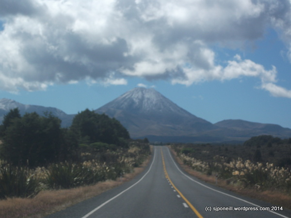
…and a good dusting on Ngauruhoe and its offsider, Tongariro…
OK, so, yes, perhaps we were a little spoilt last year with a three month summer aka drought but SNOW IN MARCH! REALLY?
At a guess, this dusting won’t last long – although more is forecast for tonight – and normal summer services may be resumed but if you’re planning on visiting the Park, pack an extra layer of woollies, some really warm sox, good gloves and a decent beanie and take a few deep breathes before opening the door to step outside…
One of the reasons that I was interested in my current part-time role at the Whakapapa Visitors Centre was that I wanted to learn more about the area in which I’ve lived for the last decade. Just how unaware on my local area I was, was made clear last year when I was the census collector for the northern part of Mt Ruapehu. What kept going through my mind was that old Tourism NZ advertisement “Don’t Leave Home til You’ve Seen the Country”
So I have set a new category “Around and About” to capture my explorations but don’t be surprised if they deviate off into other (geographic) areas as well…
I attended a farewell dinner for a friend at RNZAF Ohakea on Thursday night and woke on Friday morning to a bright sunny day (I may have appreciated the brightness and the Vampire jet buzzing the airbase if the previous night hadn’t been quite so good!). After brunching at Wendy’s and doing a little shopping in the big smoke, I set off home up SH4.
About 30km north of Wanganui, there is a signposted turn-off to Pipiriki (didn’t think to take a photo at this point). I was quite keen to drive this road as a tourist on the Visitor Centre had asked about it in my first week and I had said that I didn’t think that there was a road along the Whanganui River besides the last few kilometres of SH4 and had to be set straight by another staff member.
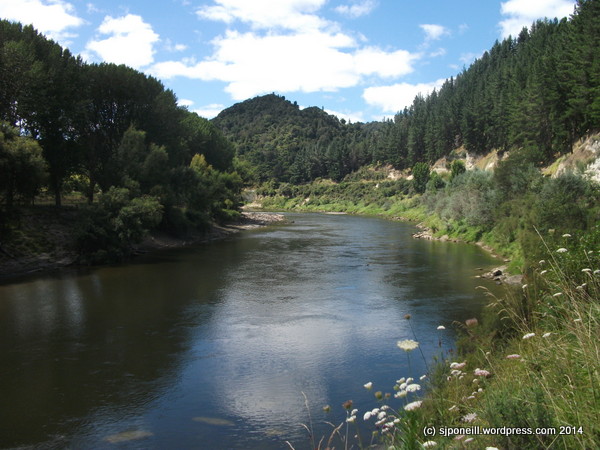
View of the Whanganui River from the lookout at the top of the first hill after you turn off SH4
I found it to be a nice drive that follows the river for 60 km to Pipiriki where it turns inland for another 30 km to pop out on SH4 again at Raetahi. It is quite narrow (down to single lanes at some points) and winding but surprisingly busy so it is essential that a driver assumes that there is oncoming traffic around every corner and is prepared to stop in half the visible road.
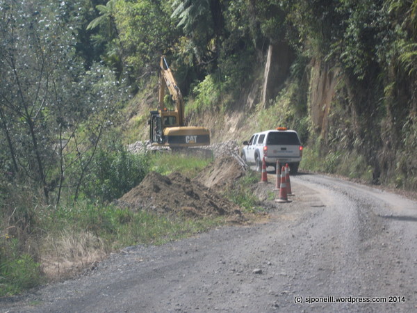
Obstacles…
…and more obstacles…
There are many single lane bridges and drivers need to be aware of who has the right of way and rural road etiquette e.g. the traffic coming up a hill generally has the right of way…
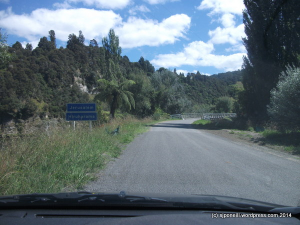
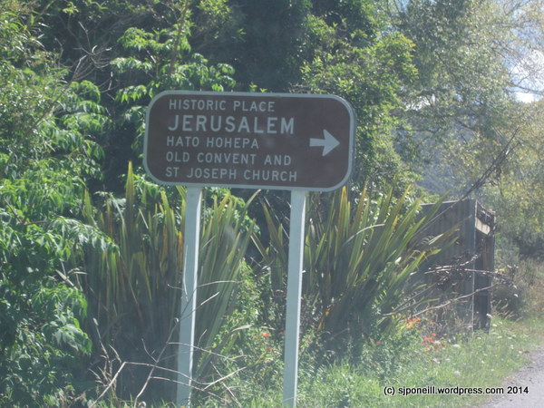
The road is always at least ten metres above the river so I think it unlikely that it gets closed often by flooding…One of those single land bridges will bring you into the historic settlement of Jerusalem…
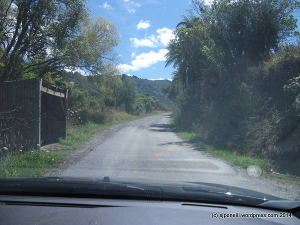
There is quite a long stretch of unsealed gravel road between Jerusalem and Pipiriki…
It is drivable in 2WD but the surface in some parts is quite loose so I popped the mighty Ssangyong into 4WD for better control and a smoother ride…
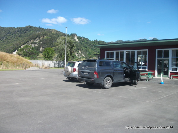
I couldn’t resist the TipTop icecream sign so popped into the Pipiriki store for a Trumpet…
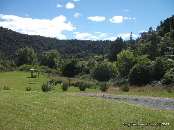
Pipiriki is a nice spot…
And then it was back on the road heading inland towards Raetihi…this road is probably more travelled and, while still narrow and winding at the river end, is certainly in better condition than the road south of Pipiriki…Halfway to Raetahi, the road breaks out onto the Central Plateau…
This is a drive that I would recommend to anyone looking to head south from the Ruapehu district with a little time to spare. I found it a nice change from SH4 direct to Wanganui or heading through Ohakune to pick up SH1 south to Wellington.
It is drivable by car i.e. 2WD but care has to be taken for other road users around the any many blind corners and single lane bridges. Small campervans i.e. those of people mover/SUV chassis would be OK but I would not be that keen on driving it in a large van-like campervan even though there are numerous small laybys where such vehicles can pull over to allow other vehicles to pass…
The scenery is nice and this drive provides and opportunity to see more of the Whanganui River than you can see from SH4 without actually having to get onto/into the river itself. If you want to get on to the river, there are opportunities to do this at Pipiriki with various canoeing, rafting and jetboating temptations…
Weekly Photo Challenge: Layers | The Daily Post. Layers. Layers can reveal, conceal, and make something more complex. They can vary in size, texture, color, or functionality. Each layer can have its own story, meaning, or purpose. They can overlap, blend, or be distinctly separate. A layer doesn’t have to be a part of a single object but can even be a slice of a multifaceted image or scene. In a new post specifically for this challenge, share a photo which means LAYERS to you!
I don’t know if anyone else uses the term but I use ‘Shrek’s Onion‘ frequently as an analogy for the necessary process in a lessons learned or continuous improvement system to peel away the layers of opinion, policy, agenda, fog of war, inadequate training, etc etc to reveal the core issue that needs to mitigated to address the original OIL (observation, issue, lesson). It’s been so long since I actually watched the original Shrekmovie before it got all franchised up that I can not actually remember the context in which the onion appears in the movie, or even if it actually does or whether it is just something that I extrapolated from something in the movie…
I felt though that I could do something a bit more than an onion for this challenge and kept an eye out when I had to drive over to Whakapapa on Saturday to look into a possible part-time position at the Department of Conservation Visitor Centre at the base of the Mountain.
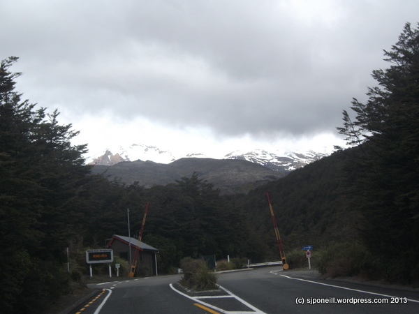
It was an overcast day and my first thought was of a sequence depicting below, through and above the cloud layer…
I set off up the road from Whakapapa Village hoping that the cloud would be low enough for the desired effect…
…unfortunately it was not to be and I probably would have climb (on foot) another thousand odd feet to get above the cloud…
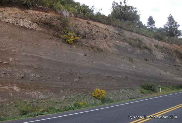
…but I did not the significant layering that is a result of the numerous volcanic eruptions over the last couple of thousand years……and on the drive back…
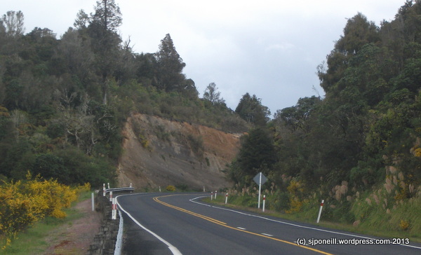
…I was able to get a more micro look at this geographic layering in the big cutting just up the road… …not being a geologist, I’m assuming that the rockier layers align with some of the bigger eruptions…
…with more recent accumulation along the top layer…
…and looking back north down the hill towards the village…
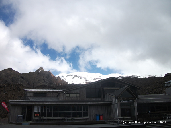
This was my first crack at Sun…I normally try to avoid it it for the obvious reason that it tends to wash out my shots and I’m too lazy to remember what camera settings will mitigate that effect (OK, that’s two obvious reasons)…in the flesh, this looked awesome as the sun burned through cloud directly over the cone of Mount Ruapehu – which is an active volcano so at first glance it appeared that it was acting up again…
But then, while aimlessly driving through Picasa, I came across this…
While not directly including the sun in the picture, the two sand buckets evoke sun, sea and surf, and the shadows on the snow offer quite a sharp contrast in both the imagery and what you can assume the ambient temperature to be…this is just one of those shots that appears a good idea at the time but which I can no longer remember what that idea might have been…and it was only last winter – or maybe that should be ‘this’ winter as the intervening summer doesn’t appear to have happened…
Note: another reason for placing my ‘best’ picture last in sequence on the page is that, when sharing or publicising via Facebook, it is always the last image that is the thumbnail for the post. I think that’s dumb too but, hey, it’s Facebook…let’s not look to closely for signs for life or logic in the machine behind the Timeline…